
Browse Items (9 total)
- Collection: Maps
Sort by:
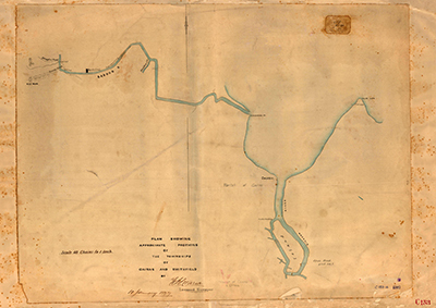
Map C153.017, Tracks to the Hodgkinson Goldfields
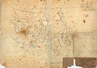
Tracing of a rough sketch of the Hodgkinson goldfields tracks leading to the coast, Sd. [sketched by] W.M. Mowbray, 31 January 1878.
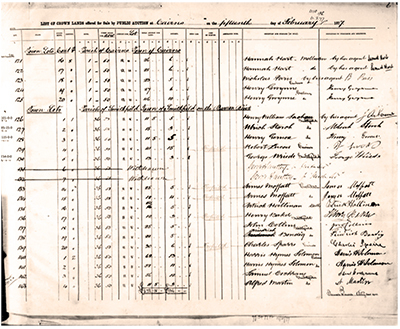
Crown Land Sales Register, Smithfield, May 1877
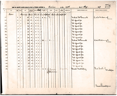
Two-page extract of the Land Sales Register, a large hard-backed register book showing sales of Crown Lands in the Colony of Queensland. This particular register is Volume 4 which contained the 1877 sales for towns beginning with the letters C-H…
Map C8.88, Smithfield Cemetery, 1878
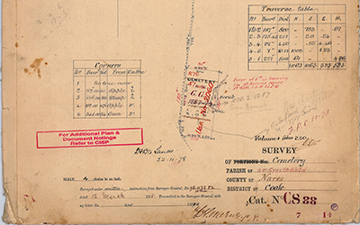
Survey of Cemetery [5 acres], Parish of Smithfield, County of Nares, District of Cook, Cat. No. C8.88. Signed and dated 'F.H. Warner L.S., 78.1173 P.L., 12 March 1878.
Map C153.012, Cairns and the Barron River
Plan showing approximate positions of the township of Cairns and Smithfield by F.H. Warner, Licensed Surveyor, dated 10 January 1877.Map shows Cairns, Dickson Inlet, False Cape, Barron River, Casuarina Pt (which was the mouth of the Barron River in…
Map S199.1, Smithfield, 1876
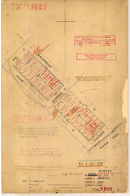
Survey of Sections Nos. 1 + 2 (Lots 1-20, & 201-220), Town of Smithfield, County of Nares, Land Administration District of Cairns, District of Cook, Cat. S199.1.Signed and dated 'F.H. Warner, 76/1, 1st Decr 1876'.
Plan of Cairns Harbour
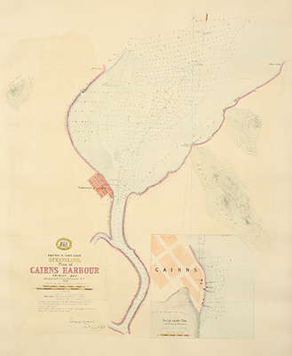
Hand coloured lithograph titled:'Plan of Cairns Harbour Trinity Bay Surveyed by Navg. Liet. E.R.Connor. R.N.'Also titled:'Australia - East Coast, Queensland : plan of Cairns Harbour, Trinity Bay, 1878'
A hydrographic chart giving soundings in feet,…
Crown Land Sales Register, Smithfield, February 1877
Two-page extract of the Land Sales Register, a large hard-backed register book showing sales of Crown Lands in the Colony of Queensland. This particular register is Volume 4 which contained the 1877 sales for towns beginning with the letters C-H…
Surveyor's Field Book, S199.2, Smithfield 1877
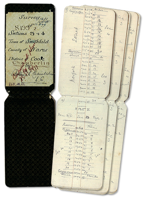
16-page surveyor's field book showing survey transects, theodolite angles, chained distances, marked trees and field observations.Title page reads:'S199.2, Survey of Sections 3 + 4, Town of Smithfield, County of Nares, District of Cook, Arthur L.…
Map S199.2, Smithfield, 1877
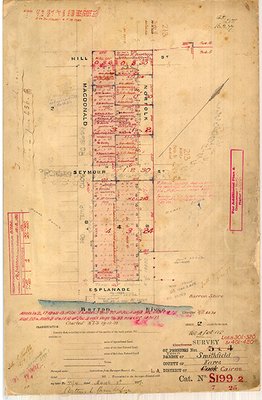
Survey of Sections Nos. 3 + 4 (Lots 301-320, & 401-420), Town of Smithfield, County of Nares, Land Administration District of Cairns, District of Cook, Cat. S199.2.Signed and dated 'Arthur L. Chamberlin, 77/4, March 8th 1877'.
Featured Item
Ungemach's Stoneware Beer Bottle
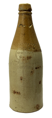
Two-tone, cream and brown, Chilean stoneware beer bottle.The bottle is stamped:'PREMIADO MEDALLA DE LA EXHIBICIÓN DE SANTIAGO 1872 / A. UNGEMACH Y…