
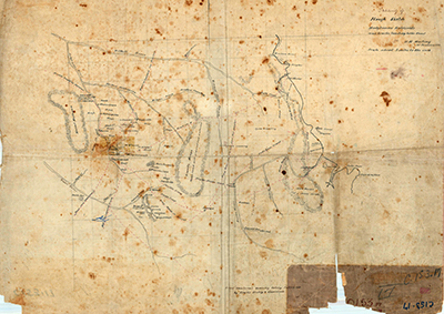
Map C153.017, Tracks to the Hodgkinson Goldfields
Dublin Core
Title
Map C153.017, Tracks to the Hodgkinson Goldfields
Identifier
Map C153.017
Description
Tracing of a rough sketch of the Hodgkinson goldfields tracks leading to the coast, Sd. [sketched by] W.M. Mowbray, 31 January 1878.
Creator
William Matthew Mowbray [Hodgkinson Mining Warden]
Subject
Cadastral maps;
Cartography;
Mapping;
Mowbray, William Matthew;
Queensland. Department of Mapping & Surveying;
Queensland--History--Maps;
Surveying & Surveyors;
Surveying--Australia--Queensland;
Surveyors -- Queensland -- History -- 19th century.
Cartography;
Mapping;
Mowbray, William Matthew;
Queensland. Department of Mapping & Surveying;
Queensland--History--Maps;
Surveying & Surveyors;
Surveying--Australia--Queensland;
Surveyors -- Queensland -- History -- 19th century.
Date
31 January 1878
Publisher
Department of Natural Resources, Mines and Energy, Queensland Government
Format
Paper map
Scale about 5 miles to the inch (1:316,802)
Scale about 5 miles to the inch (1:316,802)
Type
Still Image
Coverage
165138S1454201E
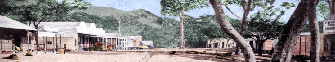
Old Smithfield township, Barron QLD 4871
Colonial Queensland
1870s
Old Smithfield township, Barron QLD 4871
Colonial Queensland
1870s
Rights
This page © 2021 oldsmithfield.com
Original item © Department of Natural Resources, Mines and Energy, Queensland Government
Original item © Department of Natural Resources, Mines and Energy, Queensland Government
Relation
See also:

Map C153.012, Cairns and the Barron River
Plan showing approximate positions of the township of Cairns and Smithfield by F.H. Warner, Licensed Surveyor, dated 10 January 1877.Map shows Cairns,…
Embed
Copy the code below into your web page
Item Relations
| Item: Plan of Cairns Harbour | is similar to | This Item |
| Item: Map C153.012, Cairns and the Barron River | is similar to | This Item |
Collection
Citation
William Matthew Mowbray [Hodgkinson Mining Warden], “Map C153.017, Tracks to the Hodgkinson Goldfields,” 31 January 1878, Map C153.017, Department of Natural Resources, Mines and Energy, Queensland Government, https://oldsmithfield.com/omeka/items/show/21.