
Cemetery Significance Statement (Part 1)
SMITHFIELD CEMETERY RESERVE (CEM.90 / R.76 / Por.46)
Stewarts Road, Barron, Queensland 4878.
Statement of Cultural Heritage Significance
© 2021 Phoenix
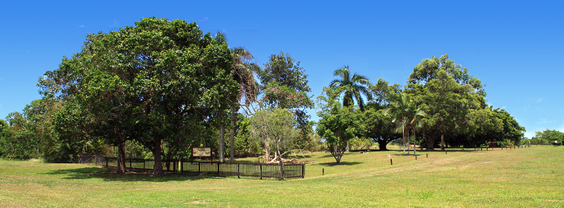
Smithfield Cemetery Reserve, looking north-east from Stewarts Road.
This statement of cultural significance was prepared by Dr Dave Phoenix in 2021 in accordance with the ICOMOS Burra Charter (1999) and the Queensland Department of Environment and Heritage Protection’s guidelines for assessing cultural heritage significance.
Part 1: Description
- Go to ⇒ Part 2: History
- Go to ⇒ Part 3: Graves
- Go to ⇒ Part 4: Land Tenure
- Go to ⇒ Part 5: Governance
- Go to ⇒ Part 5: Burials
- Go to ⇒ Part 6: Images
Description of Place:
Smithfield cemetery:
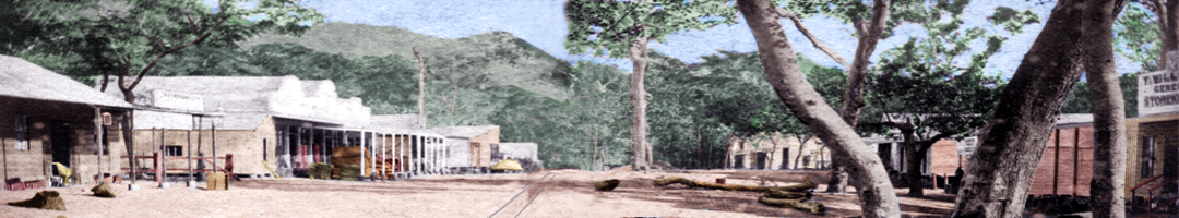
A five-acre cemetery reserve was surveyed in September 1878 to service the nearby township of Smithfield. The township had been established two years earlier and was abandoned in early 1879. The cemetery continued to be used until 1893, by which time there had been as many as 22 burials there. By 1929 agricultural activity from neighbouring cane farms had encroached on the cemetery reserve. In 1943, at the request of the farmer, the cemetery was reduced in size to 0.6 acre. Three graves were identified at this time. The cemetery was neglected and became overgrown with weeds, used as a rubbish dump and had crops planted on it. In 1987 Mulgrave Shire Council were appointed trustees and they restored the cemetery as a Bicentennial project. Only one grave is identifiable and this is marked with a low iron fence and rudimentary iron headstone.
Place Details:
Place Name:
Old Smithfield Cemetery, Stewarts Road, Smithfield.
Listings QLD Place ID:
N/A (The site is not on the Queensland Heritage Register)
Place Location:
Address:
Stewarts Road, Barron, Queensland 4878.
Lot / Plan:
CEM.90, Reserve R.76, Lot 46, Plan Nr.2060.
Coordinates:
16° 51' 53.12"S 145° 41' 36.66"E (GDA2020)
UTM 360824mE 8134945mS
Heritage Boundary:
All of the Cemetery Reserve site, two interpretive signs, the trees, the lone marked grave and a concrete plinth with a decorative iron headstone attached.
The cemetery boundaries are from 16°51 '52.5"S 145° 41' 35.4"E (north-western corner of cemetery fence near Stewarts Road) in a straight line to 16° 51 '52.7"S 145° 41' 38.0"E (north-eastern corner), then a straight line to 16° 51' 53. 7"S 145° 41' 37.9"E (south-eastern-corner) and then a straight line to 16° 51' 53.5"S 145° 41' 35.2"E (south-western-corner of cemetery fence near Stewarts Road).
A total area of 0.6 acres (2430 m2).

Aerial image of the Smithfield Cemetery Reserve.
Cairns_2020_10cm_SISP_Urban (16 July 2020), Queensland Globe, © State of Queensland 2020.
Cultural Significance:
Criterion A:
The Old Smithfield Cemetery is of historic importance at the local level. It was set aside at the request of the residents of Smithfield, as there had been a number of deaths at the township and they wanted a recognised burial ground. The reserve was used until 1893, which was well after the Smithfield township was abandoned, and the later burials were associated with deaths of local farmers in Caravonica and workers on the Cairns to Herberton railway. No trustees were appointed for the cemetery and it became badly neglected. In 1987 Mulgrave Shire were appointed trustees. They landscaped the reserve and created an open grassed area with shady trees. There is one marked grave. The locations of the other graves are unknown.
Archaeological Potential:
Although there is only one marked grave, there were multiple burials and at least one other grave was marked in the past, so the archaeological potential is high even if no additional sites are found.
Go to Cemetery Significance Statement ⇒ Part 2: History.