A History of Old Smithfield Cemetery
Smithfield Cemetery Reserve,
(CEM.90 / Reserve R.76 / Por.46),
Stewarts Road, Barron, Queensland 4878.
Overview
A five-acre cemetery reserve was surveyed in September 1878 to service the nearby township of Smithfield. The township had been established two years earlier and was abandoned in early 1879. The cemetery continued to be used until 1893, by which time there had been as many as 22 burials there. By 1929 agricultural activity from neighbouring cane farms had encroached on the cemetery reserve. In 1943, at the request of the farmer, the cemetery was reduced in size to 0.6 acre. Three graves were identified at this time. The cemetery was neglected and became overgrown with weeds, used as a rubbish dump and had crops planted on it. In 1987 Mulgrave Shire Council were appointed trustees and they restored the cemetery as a Bicentennial project. Only one grave is identifiable and this is marked with a low iron fence and rudimentary iron headstone.
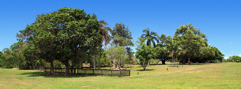
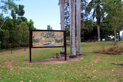
Smithfield Cemetery Reserve, looking north-east from Stewarts Road.
History
Smithfield township on the Barron River was surveyed in November 1876. Twelve months later there had been eight burials there, but the township still did not have a cemetery, and the location of these burials is unknown.
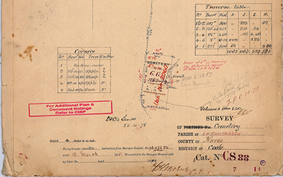
During a Ministerial visit to Smithfield in November 1877, the Smithfield Progress Association petitioned for a cemetery to be established near the town. On 12 March 1878 Acting Surveyor-General Tully instructed surveyor Frederick Horatio Warner to lay out a Cemetery Reserve. Warner marked out a five-acre allotment at Smithfield in September 1878, by which time there had been between nine and twelve burials. The reserve was half-a-mile west-south-west of the township. Presumably Warner set out the cemetery around the existing graves, but he did not mark anything on his survey plan or in his surveyor’s field-notes to indicate this was the case.The Cemetery Reserve R.76 was proclaimed on 17 December 1878 and announced in the Government Gazette four days later. There is no record to suggest that anyone was appointed trustee for the new cemetery, (whereas eight prominent Cairns and Smithfield businessmen had been appointed trustees of the McLeod Street Pioneer Cemetery in Cairns when it was surveyed in 1877).
In the interlude between Warner’s survey and the proclamation of the cemetery there had been yet another burial – eleven-day old Rebecca Crossland died on 16 November 1878 and was buried the following day. One would assume her little grave was dug in the new cemetery somewhere between the three trees and one stump at the corners of the reserve that Warner had blazed ‘C’. The Crosslands were one of the last families to leave Smithfield, and by early 1879 the township was deserted and there were no more burials for several years.
In 1883, surveyor Thomas Behan resurveyed the area and his field-notes identified just three graves, all at the northern end of the cemetery and separated by about 20 metres. There had been thirteen deaths in Smithfield thus far, with the last three burials having occurred since Warner was instructed to survey a cemetery reserve. Were these last three deaths – 30-year-old Maria MacDonald, wife of roads inspector Charles Macdonald after whom Smithfield’s Macdonald Street was named; six-year-old Christopher Kelly, whose parents William and Bridget were the proprietors of the North Star Hotel on Macdonald Street; and Rebecca Crossland, the eleven-day-old daughter of the Smithfield blacksmith Edwin and his wife Sarah; were these the first three burials in the new cemetery and the three graves that Behan saw?
At the end of 1883, eight-day old William Legren was buried at Smithfield. Legren’s family did not live in the Smithfield area, but his father, Charles Leonard Le Grande, was a construction worker on the Redlynch-Myola section of the Cairns to Herberton railway. There were no more burials for five years and then, between 1883 and 1893, there were at least eight more interments.
The last burial at Smithfield was in 1910. There have been no burials in the last 110 years.
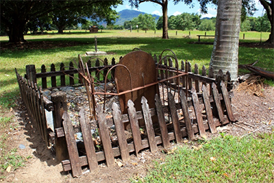
Marked grave at Smithfield Cemetery.
Reserve Details
The Cemetery Reserve is an open grassy field on the eastern side of Stewarts Road (off the Brinsmead-Kamerunga Road). The site rises towards the east, with the eastern boundary about two metres higher than the western boundary along Stewarts Road.
The site is marked with a 30 metre long colonial-style timber picket fence at the front along Stewarts Road, with a double-gate for vehicular access at the northern end and a pedestrian gate at the centre of the fence. There are two rainforest trees outside the fence on the road reserve which shade the fence and pedestrian gate. The two long sides of the reserve were fenced in 1988 with 50 pine koppers logs standing 500mm high and spaced two metres apart with a chain between the logs. The fence is in poor condition, the chain has gone and only 31 koppers logs remain, leaving large gaps in the fence and vehicles regularly access the site. The back fence also used to be koppers logs and chain, but it has been replaced with an 800mm high wire mesh fence mounted on star pickets.
There are two interpretive signs: a brown metal sign titled ‘Historic Smithfield’ with the Mulgrave Shire coat of arms which was erected in 1988 at the entrance to the site, and a more recent sign at the rear of the site which was erected by Cairns Regional Council in 2015 as part of their ‘Living with Water’ project.
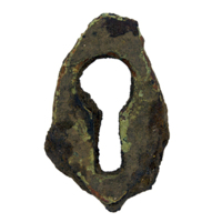
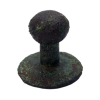
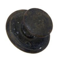
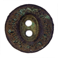
There are two large fig trees, seven palms and six other native trees on the reserve, all of which were planted by Mulgrave Shire Council in 1988. There is a wooden bench on a concrete plinth under one of the fig trees. The rear of the site has dense stand of half-a-dozen fig trees planted outside the reserve along the boundary fence.There is one marked grave with a wrought iron fence and a flat metal plate as a headstone. River rocks have been placed on the grave and a timber picket fence surrounds the grave. The timber fence was erected by Mulgrave Shire Council in 1988 and is now in poor condition. There is a second cast-iron grave marker which is detached from its original grave. In 2014 or 2015 Cairns Regional Council treated this grave marker with rust converter and mounted on a concrete plinth adjacent to the marked grave.
Ben Crossland’s interpretive sign at Smithfield Cemetery, erected in 1988.
Survey of Cemetery [5 acres], Parish of Smithfield, County of Nares, District of Cook, Cat. No. C8.88. Signed and dated 'F.H. Warner L.S., 78.1173…Map C8.88, Smithfield Cemetery, 1878
 |
This webpage is an excerpt from the upcoming book Old Smithfield: Barron River township (1876-1879) by Dr Dave Phoenix. Find Out More Here |